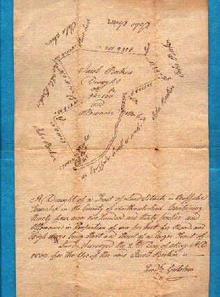
1809 Surveyor Drawn Survey Map
A
nice old Surveyors draught map dated 1809 and states: A Draught of a tract of
land situate in Buffalo Township in the county of Northumberland containing
ninety four acres one hundred and thirty perches and allowance in proportion of
six percent for roads and highways being part and parcel of a larger tract of
land surveyed the 2nd day of May A.D. 1809 for the use of the said Jacob Becker.
(signed Fredrick Gutelius). CONDITION:Folds small pin holes at fold
intersections light blemishes. SIZE:Approx. 8x12 inches.